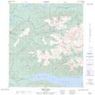
Maps showing Faith Creek, Yukon
Faith Creek is a River located in Yukon and has an elevation of 1109 meters.
- Latitude: 63° 59' 33'' North (decimal: 63.9925)
- Longitude: 135° 2' 15'' West (decimal: -135.0375)
- Topography Feature Category: River
- Geographical Feature: Creek
- Canadian Province/Territory: Yukon
- Elevation: 1109 meters
- Atlas of Canada Locator Map: Faith Creek
- GPS Coordinate Locator Map: Faith Creek Lat/Long