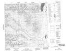
Maps showing Flat Creek, Yukon
Flat Creek is a River located in Yukon and has an elevation of 908 meters.
- Latitude: 60° 52' 16'' North (decimal: 60.8711111)
- Longitude: 133° 24' 12'' West (decimal: -133.4033333)
- Topography Feature Category: River
- Geographical Feature: Creek
- Canadian Province/Territory: Yukon
- Elevation: 908 meters
- Atlas of Canada Locator Map: Flat Creek
- GPS Coordinate Locator Map: Flat Creek Lat/Long