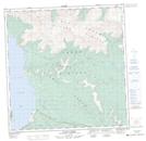
Maps showing Fourth of July Creek, Yukon
Fourth of July Creek is a River located in Yukon and has an elevation of 913 meters.
- Latitude: 61° 7' 9'' North (decimal: 61.1191666)
- Longitude: 138° 2' 9'' West (decimal: -138.0358333)
- Topography Feature Category: River
- Geographical Feature: Creek
- Canadian Province/Territory: Yukon
- Elevation: 913 meters
- Atlas of Canada Locator Map: Fourth of July Creek
- GPS Coordinate Locator Map: Fourth of July Creek Lat/Long
Fourth of July Creek NTS Map Sheets