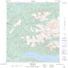
Maps showing Gambler Gulch, Yukon
Gambler Gulch is a Valley located in Yukon and has an elevation of 844 meters.
- Latitude: 63° 58' 34'' North (decimal: 63.9761111)
- Longitude: 135° 16' 51'' West (decimal: -135.2808333)
- Topography Feature Category: Valley
- Geographical Feature: Gulch
- Canadian Province/Territory: Yukon
- Elevation: 844 meters
- Atlas of Canada Locator Map: Gambler Gulch
- GPS Coordinate Locator Map: Gambler Gulch Lat/Long