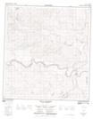
Maps showing Gull Rock, Yukon
Gull Rock is a Unincorporated area located in Yukon.
- Latitude: 62° 50' 45'' North (decimal: 62.8458000)
- Longitude: 136° 45' 30'' West (decimal: -136.7582999)
- Topography Feature Category: Unincorporated area
- Geographical Feature: Locality
- Canadian Province/Territory: Yukon
- GPS Coordinate Locator Map: Gull Rock Lat/Long
Gull Rock NTS Map Sheets