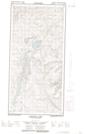
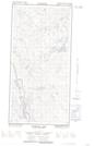
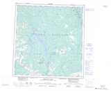
Maps showing Hopkins Lake, Yukon
Hopkins Lake is a Lake located in Yukon and has an elevation of 1032 meters.
- Latitude: 61° 15' 55'' North (decimal: 61.2652777)
- Longitude: 136° 56' 46'' West (decimal: -136.9461111)
- Topography Feature Category: Lake
- Geographical Feature: Lake
- Canadian Province/Territory: Yukon
- Elevation: 1032 meters
- Atlas of Canada Locator Map: Hopkins Lake
- GPS Coordinate Locator Map: Hopkins Lake Lat/Long
Hopkins Lake NTS Map Sheets