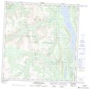
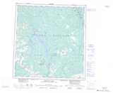
Maps showing Mount Hough, Yukon
Mount Hough is a Mountain located in Yukon and has an elevation of 2008 meters.
- Latitude: 61° 24' 22'' North (decimal: 61.4061111)
- Longitude: 137° 58' 42'' West (decimal: -137.9783333)
- Topography Feature Category: Mountain
- Geographical Feature: Mount
- Canadian Province/Territory: Yukon
- Elevation: 2008 meters
- Atlas of Canada Locator Map: Mount Hough
- GPS Coordinate Locator Map: Mount Hough Lat/Long
Mount Hough NTS Map Sheets