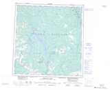
Maps showing Hutshi Lakes, Yukon
Hutshi Lakes is a Lake located in Yukon and has an elevation of 750 meters.
- Latitude: 61° 9' 3'' North (decimal: 61.1508333)
- Longitude: 136° 35' 26'' West (decimal: -136.5905556)
- Topography Feature Category: Lake
- Geographical Feature: Lakes
- Canadian Province/Territory: Yukon
- Elevation: 750 meters
- Atlas of Canada Locator Map: Hutshi Lakes
- GPS Coordinate Locator Map: Hutshi Lakes Lat/Long
Hutshi Lakes NTS Map Sheets