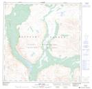
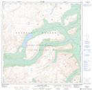
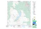
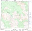
Maps showing Ibex River, Yukon
Ibex River is a River located in Yukon and has an elevation of 1315 meters.
- Latitude: 60° 50' 4'' North (decimal: 60.8344444)
- Longitude: 135° 48' 27'' West (decimal: -135.8075)
- Topography Feature Category: River
- Geographical Feature: River
- Canadian Province/Territory: Yukon
- Elevation: 1315 meters
- Atlas of Canada Locator Map: Ibex River
- GPS Coordinate Locator Map: Ibex River Lat/Long
Ibex River NTS Map Sheets
105D05 Rose Lake Topographic Map at 1:50,000 scale
105D06 Alligator Lake Topographic Map at 1:50,000 scale
105D11 Whitehorse Topographic Map at 1:50,000 scale
105D12 Mount Arkell Topographic Map at 1:50,000 scale
105D13 Thirty Seven Mile Creek Topographic Map at 1:50,000 scale
105D Whitehorse Topographic Map at 1:250,000 scale
105D06 Alligator Lake Topographic Map at 1:50,000 scale
105D11 Whitehorse Topographic Map at 1:50,000 scale
105D12 Mount Arkell Topographic Map at 1:50,000 scale
105D13 Thirty Seven Mile Creek Topographic Map at 1:50,000 scale
105D Whitehorse Topographic Map at 1:250,000 scale