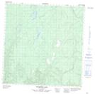
Maps showing Jackpine Lake, Yukon
Jackpine Lake is a Lake located in Yukon and has an elevation of 1032 meters.
- Latitude: 60° 39' 25'' North (decimal: 60.6569444)
- Longitude: 125° 47' 13'' West (decimal: -125.7869444)
- Topography Feature Category: Lake
- Geographical Feature: Lake
- Canadian Province/Territory: Yukon
- Elevation: 1032 meters
- Atlas of Canada Locator Map: Jackpine Lake
- GPS Coordinate Locator Map: Jackpine Lake Lat/Long
Jackpine Lake NTS Map Sheets