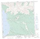
Maps showing Jenny Lake, Yukon
Jenny Lake is a Lake located in Yukon and has an elevation of 829 meters.
- Latitude: 61° 2' 37'' North (decimal: 61.0436111)
- Longitude: 138° 21' 57'' West (decimal: -138.3658333)
- Topography Feature Category: Lake
- Geographical Feature: Lake
- Canadian Province/Territory: Yukon
- Elevation: 829 meters
- Atlas of Canada Locator Map: Jenny Lake
- GPS Coordinate Locator Map: Jenny Lake Lat/Long
Jenny Lake NTS Map Sheets