Canada Topographic Maps

Klokhok River Topo Maps

Topography maps and Latitude/Longitude Location

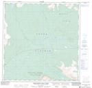
Maps showing Klokhok River, Yukon

Klokhok River is a River located in Yukon.

  • Latitude: 60° 53' 40'' North   (decimal: 60.8943999)
  • Longitude: 135° 41' 00'' West   (decimal: -135.6832999)
  • Topography Feature Category: River
  • Geographical Feature: River
  • Canadian Province/Territory: Yukon
  • GPS Coordinate Locator Map: Klokhok River Lat/Long

Klokhok River NTS Map Sheets

105D13 Thirty Seven Mile Creek Topographic Map at 1:50,000 scale

105E04E Pilot Mountain Topographic Map at 1:50,000 scale

105E04W Pilot Mountain Topographic Map at 1:50,000 scale

105D Whitehorse Topographic Map at 1:250,000 scale

105E Lake Laberge Topographic Map at 1:250,000 scale

 
Buy Topographic Maps DVD
Newsletter Sign-up

Yes, I want to receive map store discounts.


Bookmark and Share