Maps showing Kluane Lake, Yukon
Kluane Lake is a Lake located in Yukon and has an elevation of 766 meters.
- Latitude: 61° 15' 39'' North (decimal: 61.2608333)
- Longitude: 138° 46' 22'' West (decimal: -138.7727778)
- Topography Feature Category: Lake
- Geographical Feature: Lake
- Canadian Province/Territory: Yukon
- Elevation: 766 meters
- Atlas of Canada Locator Map: Kluane Lake
- GPS Coordinate Locator Map: Kluane Lake Lat/Long
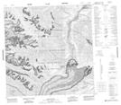
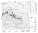
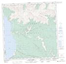
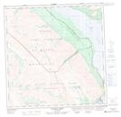
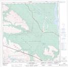
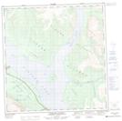
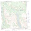
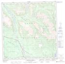
Kluane Lake NTS Map Sheets
115B15 Slims River Topographic Map at 1:50,000 scale
115B16 Jarvis River Topographic Map at 1:50,000 scale
115G01 Cultus Creek Topographic Map at 1:50,000 scale
115G02 Congdon Creek Topographic Map at 1:50,000 scale
115G06 Duke River Topographic Map at 1:50,000 scale
115G07 Burwash Landing Topographic Map at 1:50,000 scale
115G10 Serpenthead Lake Topographic Map at 1:50,000 scale
115G11 Nuntaea Creek Topographic Map at 1:50,000 scale
115B Mount St Elias Topographic Map at 1:250,000 scale
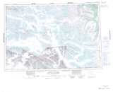
115G Kluane Lake Topographic Map at 1:250,000 scale