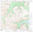
Maps showing Mount Kopje, Yukon
Mount Kopje is a Mountain located in Yukon and has an elevation of 1686 meters.
- Latitude: 60° 13' 58'' North (decimal: 60.2327777)
- Longitude: 135° 21' 35'' West (decimal: -135.3597222)
- Topography Feature Category: Mountain
- Geographical Feature: Mount
- Canadian Province/Territory: Yukon
- Elevation: 1686 meters
- Atlas of Canada Locator Map: Mount Kopje
- GPS Coordinate Locator Map: Mount Kopje Lat/Long
Mount Kopje NTS Map Sheets