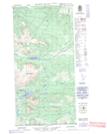
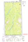
Maps showing Laidlaw Lake, Yukon
Laidlaw Lake is a Lake located in Yukon and has an elevation of 1038 meters.
- Latitude: 60° 0' 16'' North (decimal: 60.0044444)
- Longitude: 133° 15' 47'' West (decimal: -133.2630556)
- Topography Feature Category: Lake
- Geographical Feature: Lake
- Canadian Province/Territory: Yukon
- Elevation: 1038 meters
- Atlas of Canada Locator Map: Laidlaw Lake
- GPS Coordinate Locator Map: Laidlaw Lake Lat/Long
Laidlaw Lake NTS Map Sheets