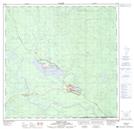
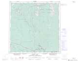
Maps showing Liard Canyon, Yukon
Liard Canyon is a Valley located in Yukon and has an elevation of 615 meters.
- Latitude: 60° 0' 0'' North (decimal: 60)
- Longitude: 128° 35' 35'' West (decimal: -128.5930556)
- Topography Feature Category: Valley
- Geographical Feature: Canyon
- Canadian Province/Territory: Yukon
- Elevation: 615 meters
- Atlas of Canada Locator Map: Liard Canyon
- GPS Coordinate Locator Map: Liard Canyon Lat/Long
Liard Canyon NTS Map Sheets