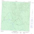
Maps showing Lookout Mountain, Yukon
Lookout Mountain is a Mountain located in Yukon and has an elevation of 1343 meters.
- Latitude: 60° 51' 18'' North (decimal: 60.855)
- Longitude: 125° 57' 6'' West (decimal: -125.9516667)
- Topography Feature Category: Mountain
- Geographical Feature: Mountain
- Canadian Province/Territory: Yukon
- Elevation: 1343 meters
- Atlas of Canada Locator Map: Lookout Mountain
- GPS Coordinate Locator Map: Lookout Mountain Lat/Long
Lookout Mountain NTS Map Sheets