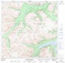
Maps showing Macauley Creek, Yukon
Macauley Creek is a River located in Yukon.
- Latitude: 60° 3' 10'' North (decimal: 60.0528000)
- Longitude: 135° 14' 10'' West (decimal: -135.2361000)
- Topography Feature Category: River
- Geographical Feature: Creek
- Canadian Province/Territory: Yukon
- GPS Coordinate Locator Map: Macauley Creek Lat/Long
Macauley Creek NTS Map Sheets