Canada Topographic Maps

MacIntosh Creek Topo Maps

Topography maps and Latitude/Longitude Location

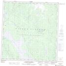
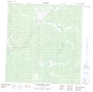
Maps showing MacIntosh Creek, Yukon

MacIntosh Creek is a River located in Yukon.

  • Latitude: 61° 57' 00'' North   (decimal: 61.9499999)
  • Longitude: 137° 17' 10'' West   (decimal: -137.2861000)
  • Topography Feature Category: River
  • Geographical Feature: Creek
  • Canadian Province/Territory: Yukon
  • GPS Coordinate Locator Map: MacIntosh Creek Lat/Long

MacIntosh Creek NTS Map Sheets

115H10E Macintosh Lake Topographic Map at 1:50,000 scale

115H10W Macintosh Lake Topographic Map at 1:50,000 scale

115H11 Tlansanlin Creek Topographic Map at 1:50,000 scale

115H14 Mackintosh Creek Topographic Map at 1:50,000 scale

115H Aishihik Lake Topographic Map at 1:250,000 scale

 
Buy Topographic Maps DVD
Newsletter Sign-up

Yes, I want to receive map store discounts.


Bookmark and Share