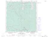
Maps showing Marten Lake, Yukon
Marten Lake is a Lake located in Yukon and has an elevation of 783 meters.
- Latitude: 60° 41' 53'' North (decimal: 60.6980555)
- Longitude: 129° 24' 29'' West (decimal: -129.4080556)
- Topography Feature Category: Lake
- Geographical Feature: Lake
- Canadian Province/Territory: Yukon
- Elevation: 783 meters
- Atlas of Canada Locator Map: Marten Lake
- GPS Coordinate Locator Map: Marten Lake Lat/Long
Marten Lake NTS Map Sheets