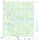
Maps showing Mayo, Yukon
Mayo is a Village located in Yukon and has an elevation of 541 meters.
- Latitude: 63° 35' 33'' North (decimal: 63.5925)
- Longitude: 135° 53' 52'' West (decimal: -135.8977778)
- Topography Feature Category: Village
- Geographical Feature: Village
- Canadian Province/Territory: Yukon
- Elevation: 541 meters
- Atlas of Canada Locator Map: Mayo
- GPS Coordinate Locator Map: Mayo Lat/Long