Canada Topographic Maps

Mayo Brook Topo Maps

Topography maps and Latitude/Longitude Location

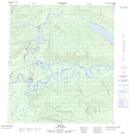
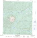
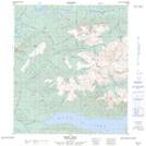
Maps showing Mayo Brook, Yukon

Mayo Brook is a River located in Yukon.

  • Latitude: 63° 35' 20'' North   (decimal: 63.5889000)
  • Longitude: 135° 54' 25'' West   (decimal: -135.9069000)
  • Topography Feature Category: River
  • Geographical Feature: Brook
  • Canadian Province/Territory: Yukon
  • GPS Coordinate Locator Map: Mayo Brook Lat/Long

Mayo Brook NTS Map Sheets

105M12 Mayo Topographic Map at 1:50,000 scale

105M13 Mount Haldane Topographic Map at 1:50,000 scale

105M14 Keno Hill Topographic Map at 1:50,000 scale

105M Mayo Topographic Map at 1:250,000 scale

 
Buy Topographic Maps DVD
Newsletter Sign-up

Yes, I want to receive map store discounts.


Bookmark and Share