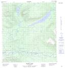
Maps showing Mist Lake, Yukon
Mist Lake is a Lake located in Yukon and has an elevation of 691 meters.
- Latitude: 63° 13' 2'' North (decimal: 63.2172222)
- Longitude: 134° 21' 24'' West (decimal: -134.3566667)
- Topography Feature Category: Lake
- Geographical Feature: Lake
- Canadian Province/Territory: Yukon
- Elevation: 691 meters
- Atlas of Canada Locator Map: Mist Lake
- GPS Coordinate Locator Map: Mist Lake Lat/Long