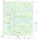
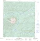
Maps showing Mud Creek, Yukon
Mud Creek is a River located in Yukon and has an elevation of 645 meters.
- Latitude: 63° 42' 33'' North (decimal: 63.7091666)
- Longitude: 135° 54' 29'' West (decimal: -135.9080556)
- Topography Feature Category: River
- Geographical Feature: Creek
- Canadian Province/Territory: Yukon
- Elevation: 645 meters
- Atlas of Canada Locator Map: Mud Creek
- GPS Coordinate Locator Map: Mud Creek Lat/Long
Mud Creek NTS Map Sheets