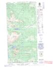
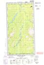
Maps showing Naystayo Lake, Yukon
Naystayo Lake is a Lake located in Yukon and has an elevation of 984 meters.
- Latitude: 60° 4' 57'' North (decimal: 60.0825)
- Longitude: 133° 22' 22'' West (decimal: -133.3727778)
- Topography Feature Category: Lake
- Geographical Feature: Lake
- Canadian Province/Territory: Yukon
- Elevation: 984 meters
- Atlas of Canada Locator Map: Naystayo Lake
- GPS Coordinate Locator Map: Naystayo Lake Lat/Long
Naystayo Lake NTS Map Sheets