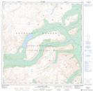
Maps showing Ptarmigan Hill, Yukon
Ptarmigan Hill is a Mountain located in Yukon and has an elevation of 1522 meters.
- Latitude: 60° 27' 46'' North (decimal: 60.4627777)
- Longitude: 135° 14' 48'' West (decimal: -135.2466667)
- Topography Feature Category: Mountain
- Geographical Feature: Hill
- Canadian Province/Territory: Yukon
- Elevation: 1522 meters
- Atlas of Canada Locator Map: Ptarmigan Hill
- GPS Coordinate Locator Map: Ptarmigan Hill Lat/Long
Ptarmigan Hill NTS Map Sheets