Maps showing Quill Creek, Yukon
Quill Creek is a Unincorporated area located in Yukon.
- Latitude: 61° 30' 26'' North (decimal: 61.5072222)
- Longitude: 139° 19' 7'' West (decimal: -139.3186111)
- Topography Feature Category: Unincorporated area
- Geographical Feature: Locality
- Canadian Province/Territory: Yukon
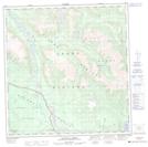
- Atlas of Canada Locator Map: Quill Creek
- GPS Coordinate Locator Map: Quill Creek Lat/Long
Quill Creek NTS Map Sheets