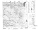
Maps showing Sidney Lake, Yukon
Sidney Lake is a Lake located in Yukon and has an elevation of 751 meters.
- Latitude: 60° 48' 22'' North (decimal: 60.8061111)
- Longitude: 133° 1' 47'' West (decimal: -133.0297222)
- Topography Feature Category: Lake
- Geographical Feature: Lake
- Canadian Province/Territory: Yukon
- Elevation: 751 meters
- Atlas of Canada Locator Map: Sidney Lake
- GPS Coordinate Locator Map: Sidney Lake Lat/Long