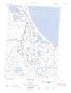
Maps showing Spring River, Yukon
Spring River is a River located in Yukon and has an elevation of 189 meters.
- Latitude: 69° 17' 00'' North (decimal: 69.2833333)
- Longitude: 138° 36' 49'' West (decimal: -138.6136111)
- Topography Feature Category: River
- Geographical Feature: River
- Canadian Province/Territory: Yukon
- Elevation: 189 meters
- Atlas of Canada Locator Map: Spring River
- GPS Coordinate Locator Map: Spring River Lat/Long
Spring River NTS Map Sheets
117D03E Crow River Topographic Map at 1:50,000 scale
117D03W Crow River Topographic Map at 1:50,000 scale
117D04 Glacier Creek Topographic Map at 1:50,000 scale
117D06E Kay Point Topographic Map at 1:50,000 scale
117D06W Kay Point Topographic Map at 1:50,000 scale
117D Herschel Island Topographic Map at 1:250,000 scale
117D03W Crow River Topographic Map at 1:50,000 scale
117D04 Glacier Creek Topographic Map at 1:50,000 scale
117D06E Kay Point Topographic Map at 1:50,000 scale
117D06W Kay Point Topographic Map at 1:50,000 scale
117D Herschel Island Topographic Map at 1:250,000 scale