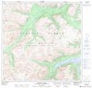
Maps showing Summit Creek, Yukon
Summit Creek is a River located in Yukon and has an elevation of 1138 meters.
- Latitude: 60° 13' 31'' North (decimal: 60.2252777)
- Longitude: 135° 15' 29'' West (decimal: -135.2580556)
- Topography Feature Category: River
- Geographical Feature: Creek
- Canadian Province/Territory: Yukon
- Elevation: 1138 meters
- Atlas of Canada Locator Map: Summit Creek
- GPS Coordinate Locator Map: Summit Creek Lat/Long
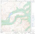
Summit Creek NTS Map Sheets