Canada Topographic Maps

Tatchun Hills Topo Maps

Topography maps and Latitude/Longitude Location

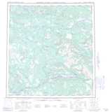
Maps showing Tatchun Hills, Yukon

Tatchun Hills is a Mountain located in Yukon and has an elevation of 1084 meters.

  • Latitude: 62° 14' 48'' North   (decimal: 62.2466666)
  • Longitude: 135° 32' 11'' West   (decimal: -135.5363889)
  • Topography Feature Category: Mountain
  • Geographical Feature: Hills
  • Canadian Province/Territory: Yukon
  • Elevation: 1084 meters
  • Atlas of Canada Locator Map: Tatchun Hills
  • GPS Coordinate Locator Map: Tatchun Hills Lat/Long

Tatchun Hills NTS Map Sheets

105L03 Little Salmon River Topographic Map at 1:50,000 scale

105L04 Frenchman Lake Topographic Map at 1:50,000 scale

105L05 Tadru Lake Topographic Map at 1:50,000 scale

105L06 Afe Peak Topographic Map at 1:50,000 scale

105L Glenlyon Topographic Map at 1:250,000 scale

 
Buy Topographic Maps DVD
Newsletter Sign-up

Yes, I want to receive map store discounts.


Bookmark and Share