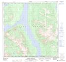
Maps showing Ten Mile, Yukon
Ten Mile is a Unincorporated area located in Yukon and has an elevation of 732 meters.
- Latitude: 60° 9' 49'' North (decimal: 60.1636111)
- Longitude: 134° 22' 38'' West (decimal: -134.3772222)
- Topography Feature Category: Unincorporated area
- Geographical Feature: Locality
- Canadian Province/Territory: Yukon
- Elevation: 732 meters
- Atlas of Canada Locator Map: Ten Mile
- GPS Coordinate Locator Map: Ten Mile Lat/Long
Ten Mile NTS Map Sheets