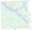
Maps showing Ten Mile Point, Yukon
Ten Mile Point is a Cape located in Yukon and has an elevation of 701 meters.
- Latitude: 60° 13' 56'' North (decimal: 60.2322222)
- Longitude: 132° 55' 0'' West (decimal: -132.9166667)
- Topography Feature Category: Cape
- Geographical Feature: Point
- Canadian Province/Territory: Yukon
- Elevation: 701 meters
- Atlas of Canada Locator Map: Ten Mile Point
- GPS Coordinate Locator Map: Ten Mile Point Lat/Long