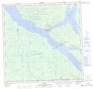
Maps showing Teslin, Yukon
Teslin is a Village located in Yukon and has an elevation of 696 meters.
- Latitude: 60° 10' 2'' North (decimal: 60.1672222)
- Longitude: 132° 43' 18'' West (decimal: -132.7216667)
- Topography Feature Category: Village
- Geographical Feature: Village
- Canadian Province/Territory: Yukon
- Elevation: 696 meters
- Atlas of Canada Locator Map: Teslin
- GPS Coordinate Locator Map: Teslin Lat/Long