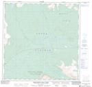
Maps showing Thirty-seven Mile Creek, Yukon
Thirty-seven Mile Creek is a River located in Yukon and has an elevation of 859 meters.
- Latitude: 60° 52' 3'' North (decimal: 60.8675)
- Longitude: 135° 45' 21'' West (decimal: -135.7558333)
- Topography Feature Category: River
- Geographical Feature: Creek
- Canadian Province/Territory: Yukon
- Elevation: 859 meters
- Atlas of Canada Locator Map: Thirty-seven Mile Creek
- GPS Coordinate Locator Map: Thirty-seven Mile Creek Lat/Long
Thirty-seven Mile Creek NTS Map Sheets