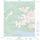
Maps showing Thunder Gulch, Yukon
Thunder Gulch is a Valley located in Yukon and has an elevation of 1353 meters.
- Latitude: 63° 53' 53'' North (decimal: 63.8980555)
- Longitude: 135° 13' 15'' West (decimal: -135.2208333)
- Topography Feature Category: Valley
- Geographical Feature: Gulch
- Canadian Province/Territory: Yukon
- Elevation: 1353 meters
- Atlas of Canada Locator Map: Thunder Gulch
- GPS Coordinate Locator Map: Thunder Gulch Lat/Long