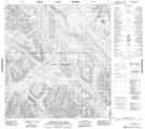
Maps showing Upper Hyland Lake, Yukon
Upper Hyland Lake is a Lake located in Yukon and has an elevation of 1249 meters.
- Latitude: 62° 2' 25'' North (decimal: 62.0402777)
- Longitude: 128° 52' 34'' West (decimal: -128.8761111)
- Topography Feature Category: Lake
- Geographical Feature: Lake
- Canadian Province/Territory: Yukon
- Elevation: 1249 meters
- Atlas of Canada Locator Map: Upper Hyland Lake
- GPS Coordinate Locator Map: Upper Hyland Lake Lat/Long
Upper Hyland Lake NTS Map Sheets