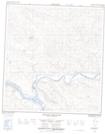
Maps showing Victoria Rock, Yukon
Victoria Rock is a Cliff located in Yukon.
- Latitude: 62° 47' 43'' North (decimal: 62.7952777)
- Longitude: 137° 27' 40'' West (decimal: -137.4611111)
- Topography Feature Category: Cliff
- Geographical Feature: Bluff
- Canadian Province/Territory: Yukon
- Atlas of Canada Locator Map: Victoria Rock
- GPS Coordinate Locator Map: Victoria Rock Lat/Long
Victoria Rock NTS Map Sheets