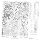
Maps showing Whitefish Lake, Yukon
Whitefish Lake is a Lake located in Yukon and has an elevation of 323 meters.
- Latitude: 67° 8' 42'' North (decimal: 67.145)
- Longitude: 137° 23' 34'' West (decimal: -137.3927778)
- Topography Feature Category: Lake
- Geographical Feature: Lake
- Canadian Province/Territory: Yukon
- Elevation: 323 meters
- Atlas of Canada Locator Map: Whitefish Lake
- GPS Coordinate Locator Map: Whitefish Lake Lat/Long
Whitefish Lake NTS Map Sheets