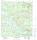
Maps showing Williamson Creek, Yukon
Williamson Creek is a River located in Yukon and has an elevation of 573 meters.
- Latitude: 63° 39' 17'' North (decimal: 63.6547222)
- Longitude: 135° 25' 49'' West (decimal: -135.4302778)
- Topography Feature Category: River
- Geographical Feature: Creek
- Canadian Province/Territory: Yukon
- Elevation: 573 meters
- Atlas of Canada Locator Map: Williamson Creek
- GPS Coordinate Locator Map: Williamson Creek Lat/Long
Williamson Creek NTS Map Sheets