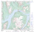
Maps showing Windy Arm, Yukon
Windy Arm is a Bay located in Yukon and has an elevation of 711 meters.
- Latitude: 60° 3' 32'' North (decimal: 60.0588888)
- Longitude: 134° 33' 12'' West (decimal: -134.5533333)
- Topography Feature Category: Bay
- Geographical Feature: Arm
- Canadian Province/Territory: Yukon
- Elevation: 711 meters
- Atlas of Canada Locator Map: Windy Arm
- GPS Coordinate Locator Map: Windy Arm Lat/Long
Windy Arm NTS Map Sheets