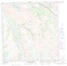
Maps showing Hidden Camp Creek, Yukon
Hidden Camp Creek is a River located in Yukon.
- Latitude: 61° 8' 57'' North (decimal: 61.1491666)
- Longitude: 139° 25' 49'' West (decimal: -139.4302778)
- Topography Feature Category: River
- Geographical Feature: Creek
- Canadian Province/Territory: Yukon
- Atlas of Canada Locator Map: Hidden Camp Creek
- GPS Coordinate Locator Map: Hidden Camp Creek Lat/Long
Hidden Camp Creek NTS Map Sheets