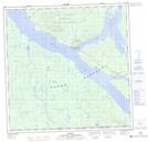
Maps showing Nà{8}as'ê X'àyí, Yukon
Nà{8}as'ê X'àyí is a Cape located in Yukon.
- Latitude: 60° 10' 43'' North (decimal: 60.1786111)
- Longitude: 132° 47' 57'' West (decimal: -132.7991666)
- Topography Feature Category: Cape
- Geographical Feature: Point
- Canadian Province/Territory: Yukon
- Atlas of Canada Locator Map: Nà{8}as'ê X'àyí
- GPS Coordinate Locator Map: Nà{8}as'ê X'àyí Lat/Long