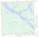
Maps showing A{4}'aká, Yukon
A{4}'aká is a River feature located in Yukon.
- Latitude: 60° 9' 32'' North (decimal: 60.1588888)
- Longitude: 132° 43' 8'' West (decimal: -132.7188889)
- Topography Feature Category: River feature
- Geographical Feature: River Mouth
- Canadian Province/Territory: Yukon
- Atlas of Canada Locator Map: A{4}'aká
- GPS Coordinate Locator Map: A{4}'aká Lat/Long