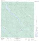
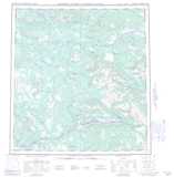
Maps showing Little Salmon River 10, Yukon
Little Salmon River 10 is a Indian Reserve located in Yukon.
- Latitude: 62° 3' 16'' North (decimal: 62.0544443)
- Longitude: 135° 40' 16'' West (decimal: -135.6711111)
- Topography Feature Category: Indian Reserve
- Geographical Feature: Indian Reserve - Réserve indienne
- Canadian Province/Territory: Yukon
- Atlas of Canada Locator Map: Little Salmon River 10
- GPS Coordinate Locator Map: Little Salmon River 10 Lat/Long
Little Salmon River 10 NTS Map Sheets