Maps showing {1}'êw X'àyi, Yukon
{1}'êw X'àyi is a Cape located in Yukon.
- Latitude: 60° 7' 25'' North (decimal: 60.1235999)
- Longitude: 132° 40' 0'' West (decimal: -132.6666998)
- Topography Feature Category: Cape
- Geographical Feature: Point
- Canadian Province/Territory: Yukon
- Atlas of Canada Locator Map: {1}'êw X'àyi
- GPS Coordinate Locator Map: {1}'êw X'àyi Lat/Long
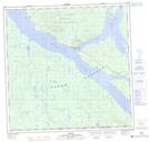
{1}'êw X'àyi NTS Map Sheets