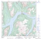
Maps showing Nàtàse Hîn, Yukon
Nàtàse Hîn is a Channel located in Yukon.
- Latitude: 60° 9' 50'' North (decimal: 60.1638888)
- Longitude: 134° 42' 27'' West (decimal: -134.7075)
- Topography Feature Category: Channel
- Geographical Feature: Narrows
- Canadian Province/Territory: Yukon
- Atlas of Canada Locator Map: Nàtàse Hîn
- GPS Coordinate Locator Map: Nàtàse Hîn Lat/Long
Nàtàse Hîn NTS Map Sheets