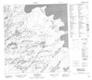
Maps showing Alexander Point, Mackenzie, Northwest Territories
Alexander Point is a Cape located in Mackenzie, Northwest Territories.
- Latitude: 62° 8' 46'' North (decimal: 62.1460195)
- Longitude: 115° 0' 5'' West (decimal: -115.0012858)
- Topography Feature Category: Cape
- Geographical Feature: Point
- Canadian Province/Territory: Northwest Territories
- Location: Mackenzie
- Atlas of Canada Locator Map: Alexander Point
- GPS Coordinate Locator Map: Alexander Point Lat/Long
Alexander Point NTS Map Sheets