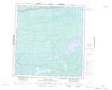
Maps showing Axe Creek, Franklin, Northwest Territories
Axe Creek is a River located in Franklin, Northwest Territories and has an elevation of 151 meters.
- Latitude: 61° 16' 0'' North (decimal: 61.2667774)
- Longitude: 118° 46' 5'' West (decimal: -118.7680897)
- Topography Feature Category: River
- Geographical Feature: Creek
- Canadian Province/Territory: Northwest Territories
- Elevation: 151 meters
- Location: Franklin
- Atlas of Canada Locator Map: Axe Creek
- GPS Coordinate Locator Map: Axe Creek Lat/Long
Axe Creek NTS Map Sheets