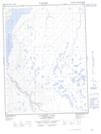
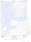
Maps showing Big Rock, Mackenzie, Northwest Territories
Big Rock is a Shoal located in Mackenzie, Northwest Territories and has an elevation of 78 meters.
- Latitude: 68° 10' 00'' North (decimal: 68.1666036)
- Longitude: 133° 38' 9'' West (decimal: -133.6358479)
- Topography Feature Category: Shoal
- Geographical Feature: Rock
- Canadian Province/Territory: Northwest Territories
- Elevation: 78 meters
- Location: Mackenzie
- Atlas of Canada Locator Map: Big Rock
- GPS Coordinate Locator Map: Big Rock Lat/Long
Big Rock NTS Map Sheets